
Last-mile delivery breaks down
Drivers end up calling repeatedly, returns rise, and actual delivery time drifts far beyond what operations teams planned for.
LandMarX presents Bawsaltak
LandMarX’s National Digital Address System combines standardized addressing, intelligent search, API verification, and 3D urban modeling so services can rely on one trusted spatial identity.
Why this matters
Non-standard addressing is not just a user inconvenience. It increases operating cost, slows response times, and makes reliable digital services harder to build.
Drivers end up calling repeatedly, returns rise, and actual delivery time drifts far beyond what operations teams planned for.
Directions like “behind the mosque” or “next to the old bakery” are not enough when an ambulance or fire crew needs an exact building target.
Verification, service routing, and field operations all need a shared address layer that people and systems can use consistently.
Who it serves
Share a clear, compact address instead of repeating a different description every time.
Reduce calls, failed drop-offs, and address ambiguity inside operational systems.
Improve pickup and drop-off precision and reduce rider-driver confusion.
Reach the right building faster when seconds matter.
Use one addressing reference for service delivery, verification, and planning.
What the platform includes
A national address model that works for people, systems, and downstream operational use.
Address, code, coordinate, and place search are handled as explicit UI and API verification flows instead of a single mixed search box.
POIs and service locations live inside a review-and-publication model rather than an unmanaged overlay.
A 2D/3D urban interface helps users identify real buildings, understand dense informal neighborhoods, and supports a broader digital-twin direction over time.
Product experience
See the partner-facing path: find the right building quickly, read its structured data, then reuse the same reference in delivery, field service, and API workflows.
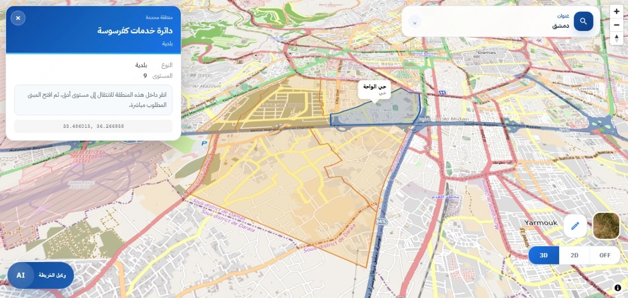
A clear search path for addresses, codes, and places inside the same map experience.

The code, structured address, coordinates, and local context become shareable and verifiable data.
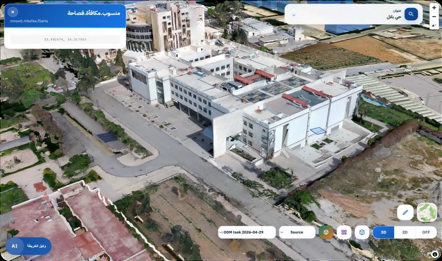
Explorable building massing helps users understand dense and informal urban fabric visually.
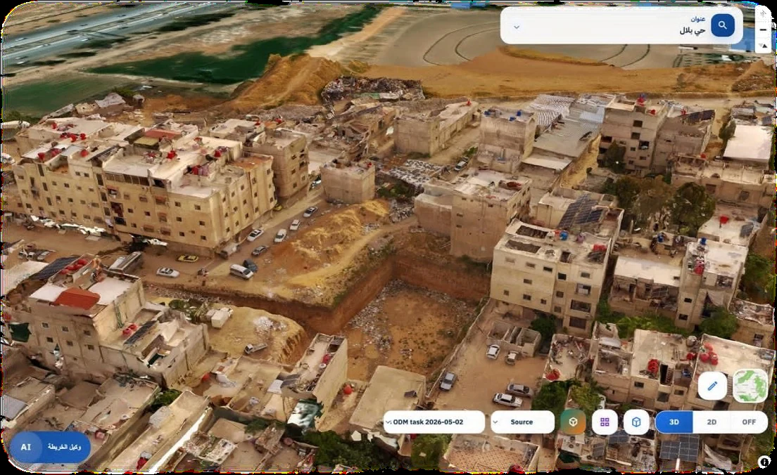
Drone imagery exposes street-level detail that generic map layers often miss.
Product proof
The current interface shows how users search by address, code, coordinates, or places, then move directly to the right building inside one 2D/3D map workflow.
API verification and integration path
Delivery companies, field-service teams, and public institutions can use the same address reference through both the interface and API services, with a clear separation between working data and published data.
GET /api/address/verify?code=SY-01-00-00123-045678
{
  "status": "verified",
  "city": "Damascus",
  "precision": "building"
}Confirm that a code points to a published building or unit in the live reference.
Use structured addresses in delivery and field-service systems instead of storing unverified text directions.
Data is exposed to end users only after explicit review and publication.
Why generic maps are not enough
Easy to start with, but hard to standardize, verify, or operate at scale.
Helpful for navigation, but not necessarily designed to function as national address infrastructure.
Human-readable, system-verifiable, and structured for real service delivery, integration, and operational trust.
From Damascus outward
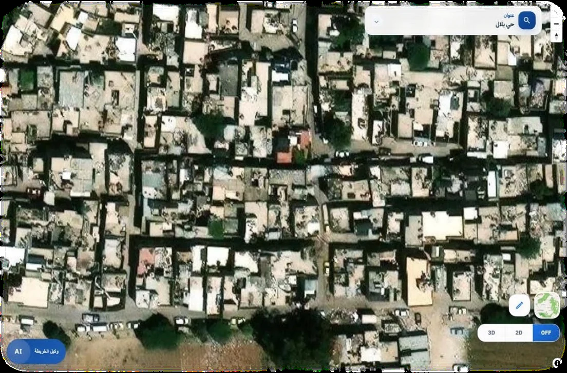
Damascus is the current pilot for operating method, validation, product proof, and dense-neighborhood 3D modeling.
The target is not a local numbering tool but a national addressing model.
The same reference layer is meant to serve residents, businesses, and institutions together.
Why the platform is credible
Clear contracts between ingestion, review, publication, and live usage.
Separation between working data and the published corpus shown to end users.
Integration paths that fit delivery systems, field operations, and public-sector services.
Common questions
No. The map matters, but the core value is a standardized address layer that can be used operationally and programmatically.
No. Government is one major beneficiary, but delivery, mobility, commerce, and everyday users all benefit from the same shared address system.
No. Damascus is the current pilot and proof geography, not the long-term ceiling.
AI helps users explore the map and reach answers faster, but it does not replace the address reference or the published data layer.
Yes. That is a core part of the platform value: address retrieval, verification, and map workflows that other services can consume.
Start with a pilot or integration discussion
The current Bawsaltak product is suitable for showing the operating model, testing key flows, and discussing pilots, institutional partnerships, or commercial integrations in Syria.